Traveling to Chattanooga is a no-brainer. The Scenic City's central location in the Southeast has multiple major interstate systems intersecting the city and an airport offering direct and 1- stop flights to a variety of destinations. Once you're here, Chattanooga has an incredibly walkable downtown boasting one of the longest pedestrian bridges in the country connecting the Northshore to the Southside as well as a 23+ miles riverwalk. And unique ways to get around town like a citywide bikeshare program and free shuttles? Yeah, we've got those too!
![]()
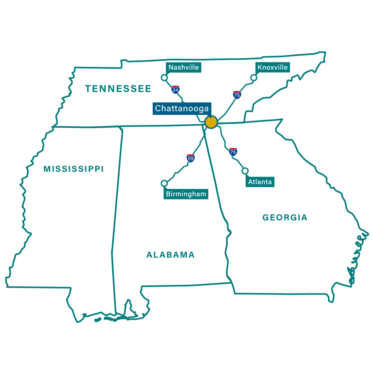
Traveling to Chattanooga by Car
Chattanooga is centrally located in the Southeast at the intersections of I-75, I-24, and I-59. OurScenic City is within three hours of more than ten million people living in Atlanta, Nashville, Knoxville, Birmingham, and Huntsville.
![]()
Traveling to Chattanooga by Plane
Chattanooga’s Airport, CHA, is just ten miles from Downtown and offers direct or 1-stop flights to a variety of destinations.
![]()
Traveling Around Chattanooga by Free Shuttle
The free electric shuttle covers all of Downtown and connects to the Northshore.
![]()
Traveling Around Chattanooga by Bikeshare
The first citywide bike share system in the South lives in Chattanooga with over 300 bikes at 40+ locations throughout the city.
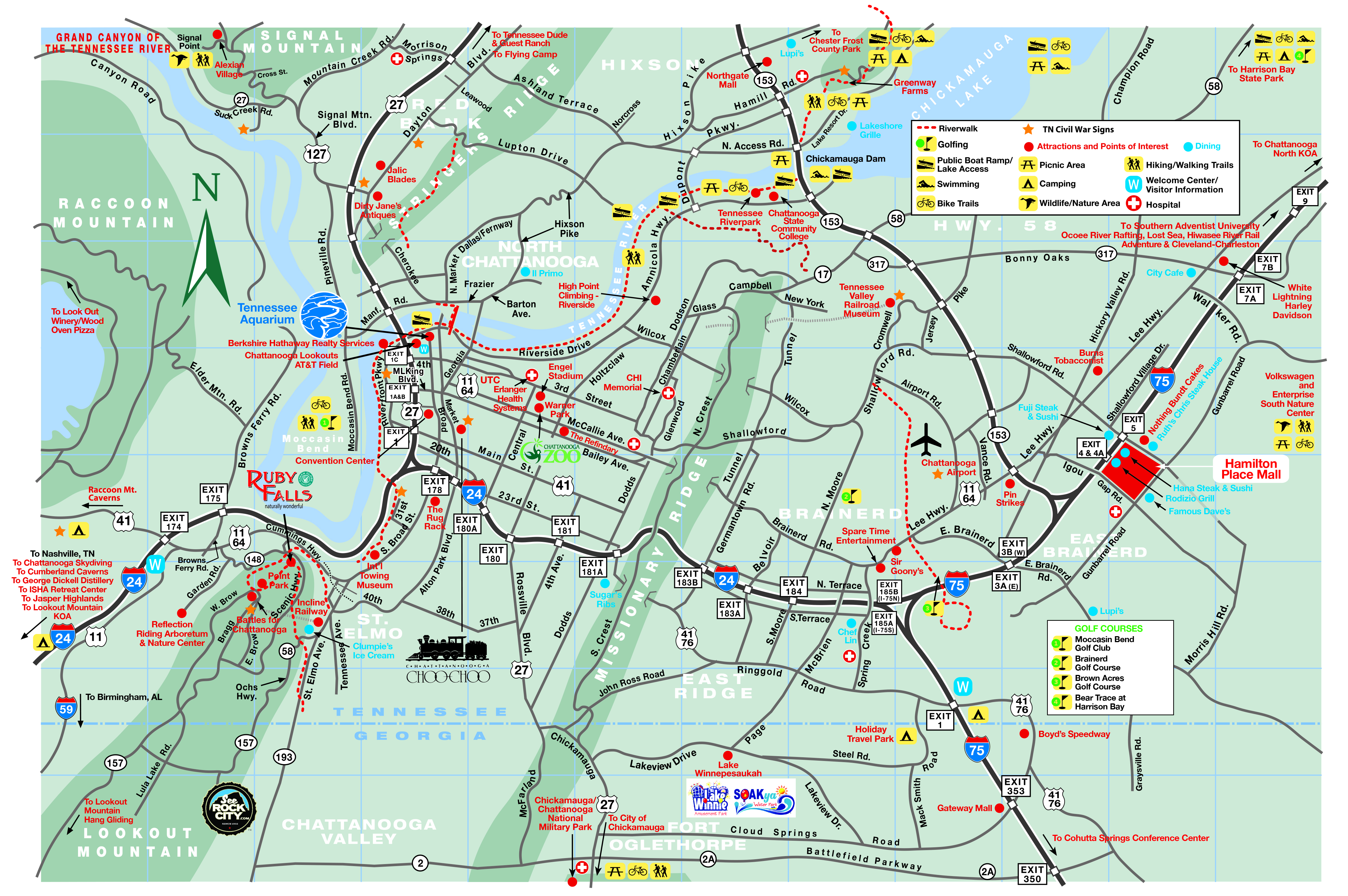


Visiting Chattanooga Map
Extensive map featuring Chattanooga attractions, restaurants, shuttle routes, and more.
Learn More
Hiking & Overlooks Map
Are you a trailblazer or a view chaser? Find trailheads and overlooks convenient to Chattanooga.
Learn More
Experience Art Map
Featuring Chattanooga Art Galleries, Public Installations, Murals, and more!
Learn More